Les Montets
Gemeente in Zwitserland  | |||
|---|---|---|---|
 | |||
  | |||
| Situering | |||
| Kanton | Fribourg | ||
| District | Broye | ||
| BFS/OFS/UST-code | 2050 | ||
| Soort gemeente | Gemeente | ||
| Aangrenzende gemeenten | Estavayer-le-Lac, Sévaz, Bussy, Cugy, Ménières, Nuvilly, Murist, Lully, Sassel | ||
| Coördinaten | 46° 49′ NB, 6° 51′ OL | ||
| Algemeen | |||
| Oppervlakte | 1035 km² | ||
| Inwoners (31-12-2017) | 1.439 (110 inw./km²) | ||
| Hoogte | 490 m | ||
| Overig | |||
| Postcode | 1483 | ||
| Taal | Frans | ||
| Website | Officiële website | ||
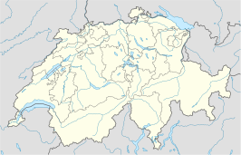
| Detailkaart | |||
 | |||
| |||

Les Montets is een gemeente in het district Broye van het kanton Fribourg in Zwitserland.
Geografie
Les Montets ligt in de exclave Estavayer van kanton Fribourg in kanton Vaud. De buurgemeenten in kanton Fribourg zijn Estavayer-le-Lac, Lully, Seiry, Murist, Nuvilly, Ménières, Fétigny, Cugy, Bussy en Sévaz. De oppervlakte van de gemeente bedraagt 10,35 km².
- Hoogste punt: 661 m
- Laagste punt: 475 m
Bevolking
De gemeente telt 1.439 inwoners. De meerderheid in Les Montets is Franstalig (84%, 2000) en Rooms-Katholiek (76%).
Economie
39% van de werkzame bevolking werkt in de primaire sector (landbouw en veeteelt), 37% in de secundaire sector (industrie), 24% in de tertiaire sector (dienstverlening).
Externe links
- Statistiek Fribourg, Duits- of Franstalig
Gemeenten in het district Broye

Belmont-Broye · Châbles · Châtillon · Cheiry · Cheyres · Cugy · Delley-Portalban · Estavayer · Fétigny · Gletterens · Les Montets · Lully · Ménières · Montagny · Nuvilly · Prévondavaux · Saint-Aubin · Sévaz · Surpierre · Vallon · Villeneuve
Mediabestanden
Zie de categorie Les Montets van Wikimedia Commons voor mediabestanden over dit onderwerp.


