Hrabstwo Putnam (Wirginia Zachodnia)
| hrabstwo | |||
 | |||
| Państwo |
| ||
|---|---|---|---|
| Stan |
| ||
| Siedziba | Winfield | ||
| Kod statystyczny | FIPS 6-4: 54079 | ||
| Powierzchnia | 907,53 km²[1] | ||
| Populacja (2010) • liczba ludności |
| ||
Położenie na mapie Wirginia Zachodnia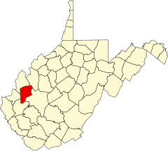 | |||
| 38°30′36″N 81°54′36″W/38,510000 -81,910000 | |||
| |||
| Strona internetowa | |||


Hrabstwo Putnam (ang. Putnam County) – hrabstwo w stanie Wirginia Zachodnia w Stanach Zjednoczonych. Obszar całkowity hrabstwa obejmuje powierzchnię 350,40 mil² (907,53 km²). Według szacunków United States Census Bureau w roku 2010 miało 55 486 mieszkańców[2].
Hrabstwo powstało w 1848 roku[3].
Miasta
- Bancroft
- Buffalo
- Eleanor
- Hurricane
- Poca
- Winfield[4]
CDP
- Hometown
- Teays Valley[4]
| Populacja hrabstwa w poprzednich latach[3] | |
|---|---|
| Rok | Liczba ludności |
| 1980 | 36 754 |
| 1990 | 42 835 |
| 2000 | 51 589 |
| 2010 | 55 486 |
Przypisy
- ↑ US Census Bureau: Population, Housing Units, Area, and Density: 2000. [dostęp 2012-05-17]. [zarchiwizowane z tego adresu (2016-03-09)]. (ang.).
- ↑ a b US Census Bureau: Putnam County. Quickfacts. [dostęp 2012-01-01]. (ang.).
- ↑ a b National Association of Counties: Putnam County, WV. [dostęp 2012-01-01]. (ang.).
- ↑ a b National Association of Counties: Places in Putnam County, WV. [dostęp 2012-01-01]. (ang.).
- p
- d
- e
Hrabstwa stanu Wirginia Zachodnia
|

Kontrola autorytatywna (hrabstwo w stanie Wirginia Zachodnia):


