Aquadoctan
43°36′16″N 71°27′21″W / 43.60444°N 71.45583°W / 43.60444; -71.45583
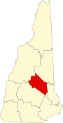
The Weirs
Aquadoctan was one of the largest known Native American villages in what is now the U.S. state of New Hampshire. In an area commonly known today as The Weirs (for the semi-permanent fishing weirs the natives had built on the river), the village lay on the north bank of the Winnipesaukee River at the outlet of Lake Winnipesaukee in the Lakes Region of New Hampshire. The site is now in Weirs Beach, a summer resort and village of the city of Laconia. The Native American village, whose archaeological remains extend for a half mile along the river and a quarter mile along the lake, has been documented through archaeological investigation to have evidence of settlement from 9,000 BCE to the late seventeenth century. Colonial reports document that the site was abandoned substantially in 1696, when most of New Hampshire's remaining native population withdrew to join the Pequawket at present-day Fryeburg, Maine.[2]
Due to documentation of its use for human settlements, the area has long been of archaeological interest. Portions of the area were investigated formally during 1976 through 1979 by a team from the University of New Hampshire, and in 1977 by Howard Sargent, long a leading figure in New Hampshire archaeology,[3] who is noted for his identification of the Hunter Archeological Site that also is in New Hampshire.
Finds at the Aquadoctan site yield evidence of habitation back to the Paleo-Indian period (c. 7600 BCE). These finds were located under Middle Archaic remains, indicating a long period of occupation. The site was one of the first in northern New England to yield evidence of human activity in that prehistoric time period.[4]
A 15-acre (6.1 ha) section of the village site was listed on the National Register of Historic Places in 1975.[1]
See also
- Endicott Rock, a state park in the area
- Beaver Meadow Brook Archeological Site
- National Register of Historic Places listings in Belknap County, New Hampshire
References
- ^ a b "National Register Information System". National Register of Historic Places. National Park Service. July 9, 2010.
- ^ Heald, Bruce (2014). A History of the New Hampshire Abenaki. The History Press. p. 57. ISBN 9781626194229.
- ^ Starbuck, David (2006). The Archeology of New Hampshire: Exploring 10,000 Years in the Granite State. University Press of New England. pp. 6, 59. ISBN 9781584655626.
- ^ Starbuck, pp. 59-61
- v
- t
- e
- Periods
- Lithic
- Archaic
- Formative
- Classic
- Post-Classic
cultures
- Adena
- Alachua
- Ancient Beringian
- Ancestral Pueblo (Anasazi)
- Anishinaabe
- Avonlea
- Baytown
- Belle Glade
- Buttermilk Creek complex
- Caborn-Welborn
- Cades Pond
- Calf Creek
- Caloosahatchee
- Clovis
- Coles Creek
- Comondú
- Deptford
- Folsom
- Fort Ancient
- Fort Walton
- Fremont
- Glacial Kame
- Glades
- Hohokam
- Hopewell
- La Jolla
- Las Palmas
- Maritime Archaic
- Mississippian
- Mogollon
- Monongahela
- Old Cordilleran
- Oneota
- Paleo-Arctic
- Paleo-Indians
- Patayan
- Plano
- Plaquemine
- Poverty Point
- Red Ocher
- Safety Harbor
- Santa Rosa-Swift Creek
- St. Johns
- Steed-Kisker
- Suwannee Valley
- Tchefuncte
- Troyville
- Weeden Island
sites
- Angel Mounds
- Anzick site
- Bandelier National Monument
- Bastian
- Benson
- Blue Spring Shelter
- Bluefish Caves
- The Bluff Point Stoneworks
- Brewster
- Cahokia
- Candelaria Cave
- Casa Grande
- Chaco Canyon
- Coso Rock Art District
- Crystal River
- Cuarenta Casas
- Cueva de la Olla
- Cutler
- Eaker
- El Fin del Mundo
- El Vallecito
- Effigy Mounds
- Etowah Indian Mounds
- Eva
- Folsom
- Fort Ancient
- Fort Center
- Fort Juelson
- Four Mounds
- Gila Cliff Dwellings
- Glenwood
- Grimes Point
- Helen Blazes
- Holly Bluff
- Hopewell Culture National Historical Park
- Horr's Island
- Huápoca
- Key Marco
- Kimball Village
- Kincaid Mounds
- Kolomoki Mounds
- Lake Jackson Mounds
- Lehner Mammoth-Kill Site
- L'Anse aux Meadows
- Lynch Quarry Site
- Marksville
- Marmes Rockshelter
- Meadowcroft Rockshelter
- Mesa Verde
- Moaning Cavern
- Moorehead Circle
- Morrison Mounds
- Moundville
- Mummy Cave
- Nodena site
- Ocmulgee Mounds
- Old Stone Fort
- Orwell site
- Paquime
- Painted Bluff
- Parkin Park
- Pinson Mounds
- Plum Bayou Mounds
- Portsmouth Earthworks
- Poverty Point
- Pueblo Bonito
- Rassawek
- Recapture Canyon
- River Styx
- Roberts Island
- Rock Eagle
- Rock Hawk
- Rosenstock Village
- Russell Cave
- Salmon Ruins
- Serpent Mound
- Sierra de San Francisco
- Shell ring sites
- Spiro Mounds
- Stallings Island
- SunWatch
- Taos Pueblo
- Town Creek Indian Mound
- Turkey River Mounds
- Upward Sun River
- Velda Mound
- West Oak Forest Earthlodge
- Wickiup Hill
- Windover
- Winterville
- Wupatki
remains
- Aridoamerica
- Ballgame
- Black drink
- Ceremonial pipe
- Chunkey
- Clovis point
- Container Revolution
- Eastern Agricultural Complex
- Eden point
- Effigy mound
- Falcon dancer
- Folsom point
- Green Corn Ceremony
- Horned Serpent
- Kiva
- Medicine wheel
- Metallurgy
- Mi'kmaq hieroglyphic writing
- Mound Builders
- N.A.G.P.R.A.
- Norse colonization of North America
- Oasisamerica
- Piasa
- Projectile point
- Southeastern Ceremonial Complex
- Stickball
- Three Sisters agriculture
- Thunderbird
- Transoceanic contact
- Underwater panther
- Water glyphs
- Related
- Genetic history
- Pre-Columbian era