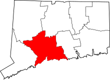
National Register of Historic Places listings in New Haven County, Connecticut
This is a list of the National Register of Historic Places listings in New Haven County, Connecticut. It is intended to be a complete list of the properties and districts on the National Register of Historic Places in New Haven County, Connecticut, United States. The locations of National Register properties and districts for which the latitude and longitude coordinates are included below, may be seen in an online map.[1]
There are 273 properties and districts listed on the National Register in the county, including 10 National Historic Landmarks. The city of New Haven is the location of 69 of these properties and districts, including 9 National Historic Landmarks; they are listed separately, while the 207 properties and districts in the remaining parts of the county, including one National Historic Landmark (Henry Whitfield House), are listed here. Three sites appear in both lists.
| Fairfield (city of Bridgeport) (town of Greenwich) (city of Stamford) | Hartford (city of Hartford) (town of Southington) (town of West Hartford) (town of Windsor) | Litchfield | Middlesex (city of Middletown) | New Haven (city of New Haven) | New London | Tolland | Windham |
This National Park Service list is complete through NPS recent listings posted September 5, 2024.[2]
Map all coordinates using OpenStreetMap
Download coordinates as:
- KML
- GPX (all coordinates)
- GPX (primary coordinates)
- GPX (secondary coordinates)
Current listings
New Haven
Exclusive of New Haven
| [3] | Name on the Register[4] | Image | Date listed[5] | Location | City or town | Description |
|---|---|---|---|---|---|---|
| 1 | George S. Abbott Building |  | June 14, 1982 (#82004359) | 235-247 N. Main St. 41°33′31″N 73°02′20″W / 41.558611°N 73.038889°W / 41.558611; -73.038889 (George S. Abbott Building) | Waterbury | 1899 all-masonry construction with unique adaptation to a triangular lot. |
| 2 | Academy of Our Lady of Mercy at Lauralton Hall |  | August 31, 2011 (#11000611) | 200 High St. 41°13′23″N 73°03′52″W / 41.223056°N 73.064444°W / 41.223056; -73.064444 (Academy of Our Lady of Mercy at Lauralton Hall) | Milford | The oldest Catholic college-preparatory school for girls in the state. |
| 3 | Acadian House |  | September 5, 1975 (#75001928) | Union St. 41°17′07″N 72°40′47″W / 41.285278°N 72.679722°W / 41.285278; -72.679722 (Acadian House) | Guilford | Served as a refuge for Acadians expelled from Nova Scotia. |
| 4 | Aeolian Company Factory Complex | Upload image | January 24, 2023 (#100008602) | 85 Tremont St. 41°33′05″N 72°47′12″W / 41.5513°N 72.7868°W / 41.5513; -72.7868 (Aeolian Company Factory Complex) | Meriden | |
| 5 | Allis-Bushnell House | 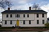 | February 25, 1982 (#82004352) | 853 Boston Post Rd. 41°16′45″N 72°35′33″W / 41.279167°N 72.5925°W / 41.279167; -72.5925 (Allis-Bushnell House) | Madison | Built in 1785; now a historic house museum. |
| 6 | American Mills Web Shop |  | March 10, 1983 (#83001276) | 114-152 US 1 41°17′44″N 72°57′20″W / 41.295556°N 72.955556°W / 41.295556; -72.955556 (American Mills Web Shop) | West Haven | Early twentieth-century Italianate industrial architecture (1903-1914). |
| 7 | William Andrew House |  | December 27, 2002 (#02001695) | 131 Old Tavern Rd. 41°15′55″N 73°00′44″W / 41.265278°N 73.012222°W / 41.265278; -73.012222 (William Andrew House) | Orange | Georgian colonial residence. |
| 8 | Moses Andrews House |  | December 1, 1978 (#78002859) | 424 W. Main St. 41°32′23″N 72°49′03″W / 41.539722°N 72.8175°W / 41.539722; -72.8175 (Moses Andrews House) | Meriden | Circa 1760 saltbox house. |
| 9 | Ansonia Library |  | August 23, 1985 (#85001828) | 53 South Cliff St. 41°20′43″N 73°04′37″W / 41.345278°N 73.076944°W / 41.345278; -73.076944 (Ansonia Library) | Ansonia | Richardsonian Romanesque building from 1892. |
| 10 | George Atwater House | 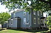 | January 17, 1992 (#91001921) | 1845 State St. 41°19′57″N 72°54′01″W / 41.3325°N 72.900278°W / 41.3325; -72.900278 (George Atwater House) | Hamden | Well-preserved 1820 vernacular farmhouse. |
| 11 | Atwater-Linton House |  | January 17, 1992 (#91001923) | 1804 State St. 41°19′53″N 72°54′01″W / 41.3314°N 72.9003°W / 41.3314; -72.9003 (Atwater-Linton House) | Hamden | Home of William James Linton (1812-1897), English-born artist, engraver, author, and political reformer. |
| 12 | George Baldwin House | 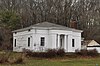 | September 15, 1977 (#77001411) | West of North Branford at 530 Foxon Rd. 41°19′54″N 72°48′17″W / 41.331667°N 72.804722°W / 41.331667; -72.804722 (George Baldwin House) | North Branford | Greek Revival design attributed to Ithiel Town. |
| 13 | Timothy Baldwin House | 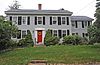 | December 1, 1988 (#88002633) | 186 Damascus Rd. 41°17′12″N 72°46′56″W / 41.286667°N 72.782222°W / 41.286667; -72.782222 (Timothy Baldwin House) | Branford | Colonial from 1819. |
| 14 | Zaccheus Baldwin House |  | December 1, 1988 (#88002631) | 154 Damascus Rd. 41°17′10″N 72°47′09″W / 41.286111°N 72.785833°W / 41.286111; -72.785833 (Zaccheus Baldwin House) | Branford | Late 18th-century Colonial. |
| 15 | Bank Street Historic District |  | July 28, 1983 (#83001277) | 207-231 Bank St. 41°33′11″N 73°02′30″W / 41.553056°N 73.041667°W / 41.553056; -73.041667 (Bank Street Historic District) | Waterbury | Isolated group of four late 19th-century brick buildings, including one of only two Queen Anne commercial buildings in Waterbury. |
| 16 | John Barker House |  | August 3, 1974 (#74002051) | 898 Clintonville Rd. 41°24′46″N 72°49′29″W / 41.4127°N 72.8246°W / 41.4127; -72.8246 (John Barker House) | Wallingford | Gambrel-roofed brick house from 1756. |
| 17 | Samuel Beach House |  | December 1, 1988 (#88002634) | 94 E. Main St. 41°17′13″N 72°48′24″W / 41.286944°N 72.806667°W / 41.286944; -72.806667 (Samuel Beach House) | Branford | Wood-frame house built circa 1790 with a steep side-gable roof, central chimney, and clapboarded exterior. |
| 18 | Benedict-Miller House | 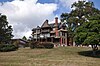 | June 12, 1981 (#81000616) | 32 Hillside Ave. 41°33′42″N 73°02′30″W / 41.561667°N 73.041667°W / 41.561667; -73.041667 (Benedict-Miller House) | Waterbury | Queen Anne house from 1879, designed by Palliser, Palliser & Company. |
| 19 | Beth El Synagogue |  | May 11, 1995 (#95000560) | 359-375 Cooke St. 41°34′03″N 73°02′27″W / 41.5675°N 73.040833°W / 41.5675; -73.040833 (Beth El Synagogue) | Waterbury | Byzantine Revival building with gold dome built in 1929. |
| 20 | Birmingham Green Historic District | 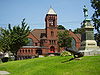 | April 21, 2000 (#00000325) | Roughly bounded by 5th, Caroline, 4th, and Olivia Sts. 41°19′21″N 73°05′20″W / 41.32242°N 73.089026°W / 41.32242; -73.089026 (Birmingham Green Historic District) | Derby | Town green surrounded by three churches, the Sterling Opera House and other historic structures. |
| 21 | Bishop School |  | November 30, 1982 (#82001003) | 178 Bishop St. 41°33′50″N 73°02′12″W / 41.563889°N 73.036667°W / 41.563889; -73.036667 (Bishop School) | Waterbury | Built in 1886, with subsequent expansions, in an eclectic mix of Italianate and Romanesque Revival styles, to serve a growing immigrant population. |
| 22 | Blackstone House | 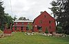 | December 1, 1988 (#88002639) | 37 1st Ave. 41°15′58″N 72°47′11″W / 41.266111°N 72.786389°W / 41.266111; -72.786389 (Blackstone House) | Branford | 18th-century timber-frame structure, with a steeply pitched gabled roof, central chimney and clapboarded exterior. |
| 23 | Joseph Blakeslee House |  | April 13, 1998 (#98000362) | 1211 Barnes Rd. 41°28′47″N 72°46′03″W / 41.479722°N 72.7675°W / 41.479722; -72.7675 (Joseph Blakeslee House) | Wallingford | Late 18th-century Cape style residence; collapsed and demolished in 2008.[6] |
| 24 | Timothy Bradley House | 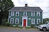 | December 1, 1988 (#88002630) | 12 Bradley St. 41°16′36″N 72°49′14″W / 41.276667°N 72.820556°W / 41.276667; -72.820556 (Timothy Bradley House) | Branford | Built circa 1730, with a gabled roof, central chimney, and clapboarded exterior; in the Canoe Brook Historic District. |
| 25 | Branford Center Historic District |  | May 6, 1987 (#87000636) | Roughly bounded by U.S. Route 1, the Branford River on the east and the south, and Monroe and Kirkham Sts. 41°16′42″N 72°48′45″W / 41.278333°N 72.8125°W / 41.278333; -72.8125 (Branford Center Historic District) | Branford | Highlights include the neoclassical town hall (1857) and James Blackstone Memorial Library (1893). |
| 26 | Branford Electric Railway Historic District |  | June 3, 1983 (#83001278) | 17 River St. to Court St. 41°15′59″N 72°51′21″W / 41.266389°N 72.855833°W / 41.266389; -72.855833 (Branford Electric Railway Historic District) | Branford and East Haven | Trolley line and historic trolley collection. |
| 27 | Branford Point Historic District |  | September 15, 1988 (#88001583) | Roughly along Harbor St. north from Curve St. to Branford Point and also Maple St. east from Reynolds St. to Harbor St. 41°15′57″N 72°49′18″W / 41.265833°N 72.821667°W / 41.265833; -72.821667 (Branford Point Historic District) | Branford | Residences in a range of styles including late Federal, Greek Revival, Italianate, Second Empire, Stick, Queen Anne, Arts and Crafts, Shingle, and Colonial Revival. |
| 28 | Bridge No. 1132 |  | September 29, 2004 (#04001091) | CT 80 at the Hammonasset River 41°21′26″N 72°36′45″W / 41.357222°N 72.612553°W / 41.357222; -72.612553 (Bridge No. 1132) | Madison | Open-spandrel concrete arch bridge built in 1934; extends into Killingworth in Middlesex County. |
| 29 | Aaron Bronson House | 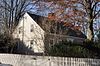 | July 29, 1993 (#93000656) | 846 Southford Rd. 41°28′17″N 73°10′58″W / 41.4715°N 73.1827°W / 41.4715; -73.1827 (Aaron Bronson House) | Southbury | Well-preserved Cape from about 1785. |
| 30 | Josiah Bronson House |  | February 25, 1982 (#82004356) | Breakneck Hill Rd. 41°32′51″N 73°07′29″W / 41.5475°N 73.124722°W / 41.5475; -73.124722 (Josiah Bronson House) | Middlebury | Wood-frame structure built about 1738 with a gabled roof, central chimney, and clapboarded exterior. The Marquis de Lafayette and his troops camped in the area during the American Revolutionary War in 1781 and 1782. |
| 31 | Buckingham House |  | July 25, 1977 (#77001406) | 61 North St. 41°13′42″N 73°03′25″W / 41.228333°N 73.056944°W / 41.228333; -73.056944 (Buckingham House) | Milford | Circa 1725 house with beaded front clapboards, dutch doors, and beautifully designed interior woodwork. |
| 32 | Bullet Hill School | 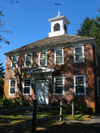 | February 23, 1972 (#72001346) | Main St. and Seymour Rd. 41°28′56″N 73°12′50″W / 41.482222°N 73.213889°W / 41.482222; -73.213889 (Bullet Hill School) | Southbury | One of the oldest brick school buildings in Connecticut. |
| 33 | Thomas Burgis II House | 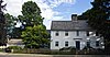 | December 28, 2000 (#00001562) | 85 Boston St. 41°16′56″N 72°40′41″W / 41.282222°N 72.678056°W / 41.282222; -72.678056 (Thomas Burgis II House) | Guilford | Circa 1735 Colonial saltbox house. |
| 34 | Canoe Brook Historic District |  | April 11, 2002 (#02000335) | Roughly along Bradley St., Cherry Hill Rd., Home Place, Lincoln Ave., and Main and N. Harbor Sts. 41°16′37″N 72°49′21″W / 41.276944°N 72.8225°W / 41.276944; -72.8225 (Canoe Brook Historic District) | Branford | Residential area first settled in the 1680s; includes the Harrison House Museum and the Thomas Harrison House, the district's oldest surviving buildings. |
| 35 | Dr. Andrew Castle House | 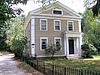 | March 31, 2000 (#00000299) | 555 Amity Rd. 41°22′38″N 73°00′04″W / 41.377222°N 73.001111°W / 41.377222; -73.001111 (Dr. Andrew Castle House) | Woodbridge | High-style Greek Revival from 1838; home of three prominent local physicians. |
| 36 | Center Street Cemetery |  | August 1, 1997 (#97000833) | 2 Center St. 41°27′19″N 72°49′26″W / 41.455278°N 72.823889°W / 41.455278; -72.823889 (Center Street Cemetery) | Wallingford | Dating from about 1670, this cemetery has memorials to Lyman Hall and Moses Yale Beach. |
| 37 | Charter Oak Firehouse | 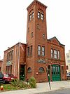 | March 17, 1994 (#94000255) | 105 Hanover St. 41°32′12″N 72°48′24″W / 41.536667°N 72.806667°W / 41.536667; -72.806667 (Charter Oak Firehouse) | Meriden | Romanesque building from 1876 with prominent four-story tower. |
| 38 | Chatfield Farmstead |  | March 15, 2010 (#10000061) | 265 Seymour Rd. 41°23′36″N 73°02′35″W / 41.393386°N 73.043094°W / 41.393386; -73.043094 (Chatfield Farmstead) | Woodbridge | Gothic revival main house and three level bank barn. |
| 39 | Cheshire Historic District |  | August 29, 1986 (#86002793) | Roughly bounded by Main St., Highland Ave., Wallingford Rd., S. Main, Cornwall, and Spring Sts. 41°29′50″N 72°54′15″W / 41.497222°N 72.904167°W / 41.497222; -72.904167 (Cheshire Historic District) | Cheshire | Noteworthy eighteenth and nineteenth century structures including the Cheshire Town Hall, Congregational Church, Hitchcock-Phillips House and Abijah Beach Tavern. |
| 40 | Colony Street-West Main Street Historic District |  | September 4, 1987 (#87001387) | 1-62 Colony, 55 Grove, 1-119 and 82-110 W. Main Sts. 41°32′19″N 72°48′17″W / 41.538611°N 72.804722°W / 41.538611; -72.804722 (Colony Street-West Main Street Historic District) | Meriden | Commercial and mixed residential-commercial buildings built from about 1850 to 1940. |
| 41 | Congregation Mishkan Israel | 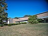 | May 20, 2021 (#100006598) | 785 Ridge Rd. 41°21′22″N 72°54′04″W / 41.3562°N 72.9011°W / 41.3562; -72.9011 (Congregation Mishkan Israel) | Hamden | Mid-twentieth-century modern synagogue; congregation long associated with the civil rights movement. |
| 42 | Curtis Memorial Library |  | April 27, 1981 (#81000618) | 175 E. Main St. 41°32′08″N 72°47′53″W / 41.535556°N 72.798056°W / 41.535556; -72.798056 (Curtis Memorial Library) | Meriden | Classical revival built in 1903 from white Vermont marble and topped with a copper dome. |
| 43 | Reuben Curtiss House |  | July 29, 1993 (#93000658) | 1770 Bucks Hill Rd. 41°28′33″N 73°10′11″W / 41.4758°N 73.1697°W / 41.4758; -73.1697 (Reuben Curtiss House) | Southbury | Built in 1840, incorporating earlier elements, resulting in a blend of Colonial and Greek Revival styles. |
| 44 | Thomas Darling House and Tavern |  | January 17, 1979 (#79002639) | East of Woodbridge at 1907 Litchfield Turnpike 41°21′41″N 72°58′59″W / 41.3614°N 72.9830°W / 41.3614; -72.9830 (Thomas Darling House and Tavern) | Woodbridge | Well-preserved Colonial Cape from 1774. |
| 45 | James Alexis Darling House | 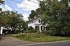 | September 4, 2020 (#100005527) | 1932 Litchfield Trnpk. (CT 69) 41°21′53″N 72°58′56″W / 41.3646°N 72.9822°W / 41.3646; -72.9822 (James Alexis Darling House) | Woodbridge | Greek revival farmhouse from 1842. |
| 46 | Depot Street Bridge | March 9, 2007 (#07000108) | Depot St. 41°26′31″N 73°03′48″W / 41.4419°N 73.0633°W / 41.4419; -73.0633 (Depot Street Bridge) | Beacon Falls | Parker through truss. | |
| 47 | Jonathan Dickerman II House |  | April 15, 1982 (#82004351) | 105 Mt. Carmel Ave. 41°25′11″N 72°54′02″W / 41.4197°N 72.9006°W / 41.4197; -72.9006 (Jonathan Dickerman II House) | Hamden | Build about 1795, a well-preserved and unusual example of late Georgian architecture. |
| 48 | Downtown Seymour Historic District | 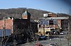 | August 25, 1983 (#83001279) | Roughly bounded by the Naugatuck River, Main, Wakeley, and DeForest Sts. 41°23′39″N 73°04′28″W / 41.3942°N 73.0744°W / 41.3942; -73.0744 (Downtown Seymour Historic District) | Seymour | Late-nineteenth and early twentieth-century commercial, civic, industrial and residential buildings reflect the town’s historical development. |
| 49 | Downtown Waterbury Historic District |  | August 3, 1983 (#83001280) | Roughly bounded by Main, Meadow, and Elm Sts. 41°33′19″N 73°02′34″W / 41.5553°N 73.0428°W / 41.5553; -73.0428 (Downtown Waterbury Historic District) | Waterbury | Historic core of downtown Waterbury, with most buildings from era after early 20th-century fire. |
| 50 | Dudley Farm Historic District | Upload image | January 24, 2023 (#100008609) | 2351 Durham Rd. 41°21′16″N 72°43′12″W / 41.3545°N 72.7199°W / 41.3545; -72.7199 (Dudley Farm Historic District) | Guilford | |
| 51 | Dudleytown Historic District |  | August 9, 1991 (#91000951) | Roughly Clapboard Hill Rd. from Tanner Marsh Rd. to Murray Ln., East River Rd. southeast to Trailwood Dr., and Duck Hole Rd. 41°17′58″N 72°39′29″W / 41.2994°N 72.6581°W / 41.2994; -72.6581 (Dudleytown Historic District) | Guilford | Primarily rural vernacular residences and farm outbuildings of the 18th and 19th centuries. |
| 52 | East Haven Green Historic District |  | April 11, 2002 (#02000336) | 263, 270, 274 Hemingway Ave., 125, 129, 133, 139, 143, 150 Main St., 3, 7, 11, 15, 23, 27, 39, 47 Park Pl., and 58 and 100 River St. 41°16′28″N 72°52′03″W / 41.2744°N 72.8675°W / 41.2744; -72.8675 (East Haven Green Historic District) | East Haven | Town green and surrounding area including two cemeteries as well as 18th and 19th century houses in Colonial, Italianate and Queen Anne styles. |
| 53 | East Haven High School |  | April 23, 2020 (#100005190) | 200 Tyler St. 41°16′31″N 72°52′34″W / 41.2753°N 72.8761°W / 41.2753; -72.8761 (East Haven High School) | East Haven | Three-story masonry former high school built in 1936. |
| 54 | East Rock Park |  | April 15, 1997 (#97000299) | Roughly bounded by State, Davis, and Livingston Sts., Park and Mitchell Drs., and Whitney Ave. 41°19′41″N 72°54′21″W / 41.3281°N 72.9058°W / 41.3281; -72.9058 (East Rock Park) | Hamden | Designed by the Olmsted Brothers and Donald Grant Mitchell; surmounted by the Soldiers' and Sailors' Monument. |
| 55 | Edgerton |  | September 19, 1988 (#88001469) | 840 Whitney Ave. 41°20′04″N 72°54′51″W / 41.3345°N 72.9143°W / 41.3345; -72.9143 (Edgerton) | Hamden | This 20-acre (8.1 ha) historic district is a public park, the site of the estate of Frederick F. Brewster, the industrialist. The 1909 mansion was demolished in 1964 leaving the gatehouse, carriage house, greenhouses, other structures, and landscaped grounds.[7]: 4, 6 Extends into New Haven. |
| 56 | Eells-Stow House |  | June 17, 1977 (#77001407) | 34 High St. 41°13′08″N 73°03′28″W / 41.2189°N 73.0578°W / 41.2189; -73.0578 (Eells-Stow House) | Milford | The oldest portions of this saltbox date to about 1700. |
| 57 | Jared Eliot House |  | November 14, 1985 (#85002792) | 88 Old Chaffinch Island Rd. 41°16′17″N 72°41′17″W / 41.2714°N 72.6881°W / 41.2714; -72.6881 (Jared Eliot House) | Guilford | Built in 1723 by Jared Eliot, minister, physician, author and agriculturalist. |
| 58 | Elton Hotel |  | June 30, 1983 (#83001282) | 16-30 W. Main St. 41°33′24″N 73°02′30″W / 41.5567°N 73.0417°W / 41.5567; -73.0417 (Elton Hotel) | Waterbury | 1906 Second Renaissance Revival hotel built in the wake of fire to replace the lost Scovill Hotel. |
| 59 | Falkner's Island Lighthouse |  | May 29, 1990 (#89001467) | Long Island Sound, 5 miles south of Guilford 41°12′42″N 72°39′15″W / 41.2117°N 72.6542°W / 41.2117; -72.6542 (Falkner's Island Lighthouse) | Guilford | Commissioned by President Thomas Jefferson and constructed in 1802. |
| 60 | Farmington Canal-New Haven and Northampton Canal |  | September 12, 1985 (#85002664) | Roughly from Suffield in Hartford County to New Haven in New Haven County 41°19′26″N 72°55′51″W / 41.3239°N 72.9308°W / 41.3239; -72.9308 (Farmington Canal-New Haven and Northampton Canal) | Hamden, Cheshire, and New Haven | Built as a canal, later became a railroad line, and now a multi-use trail. Extends into New Haven as well as into Hartford County. |
| 61 | Farmington Canal Lock |  | February 16, 1973 (#73001949) | 487 N. Brooksvale Rd. 41°28′34″N 72°55′23″W / 41.4761°N 72.9231°W / 41.4761; -72.9231 (Farmington Canal Lock) | Cheshire | 1822 lock on the Farmington Canal |
| 62 | Farmington Canal Lock No. 13 |  | May 6, 1982 (#82004350) | Brooksvale Ave. 41°27′32″N 72°55′06″W / 41.4589°N 72.9183°W / 41.4589; -72.9183 (Farmington Canal Lock No. 13) | Hamden | Unrestored lock on the Farmington Canal |
| 63 | First Congregational Church of Cheshire | 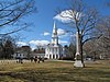 | February 16, 1973 (#73001950) | 111 Church Dr. 41°29′53″N 72°54′13″W / 41.4981°N 72.9036°W / 41.4981; -72.9036 (First Congregational Church of Cheshire) | Cheshire | Federal-style church designed by David Hoadley and built in 1827. |
| 64 | First Congregational Church of East Haven | 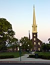 | March 25, 1982 (#82004349) | 251 Main St. 41°16′41″N 72°52′19″W / 41.2781°N 72.8719°W / 41.2781; -72.8719 (First Congregational Church of East Haven) | East Haven | One of Connecticut's few surviving pre-Revolutionary churches and one of New England's oldest stone churches. |
| 65 | Fourth District School | 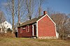 | August 29, 1985 (#85001917) | Old Post Rd. 41°23′41″N 72°47′28″W / 41.3947°N 72.7911°W / 41.3947; -72.7911 (Fourth District School) | North Branford | Late 18th-century wood-frame schoolhouse; moved from its original location in 1928, with a major restoration in 1965. |
| 66 | Edward Frisbie Homestead |  | May 16, 1985 (#85001058) | 240 Stony Creek Rd. 41°16′31″N 72°45′27″W / 41.275278°N 72.7575°W / 41.275278; -72.7575 (Edward Frisbie Homestead) | Branford | Elegant circa 1790 clapboard house. |
| 67 | Edward Frisbie House |  | December 1, 1988 (#88002638) | 699 E. Main St. 41°18′15″N 72°45′22″W / 41.304167°N 72.756111°W / 41.304167; -72.756111 (Edward Frisbie House) | Branford | Fine Georgian house from about 1750. |
| 68 | Lewis Fulton Memorial Park | 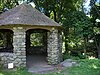 | December 27, 1990 (#90001951) | Roughly bounded by Cook, Pine, Fern and Charlotte Sts. 41°34′14″N 73°02′22″W / 41.5706°N 73.0394°W / 41.5706; -73.0394 (Lewis Fulton Memorial Park) | Waterbury | Designed by the Olmsted Brothers landscape architects and largely completed by 1925. |
| 69 | Solomon Goffe House |  | January 16, 1979 (#79002645) | 677 N. Colony St. 41°33′10″N 72°47′19″W / 41.552778°N 72.788611°W / 41.552778; -72.788611 (Solomon Goffe House) | Meriden | Historic saltbox house |
| 70 | Griswold House |  | October 10, 1975 (#75001929) | Boston St. 41°17′00″N 72°40′29″W / 41.283333°N 72.674722°W / 41.283333; -72.674722 (Griswold House) | Guilford | Late 18th-century saltbox house. The property also includes a blacksmith shop, a barn, two corn cribs and a three-seat outhouse. |
| 71 | Guilford Historic Town Center |  | July 6, 1976 (#76001988) | Bounded by West River, Interstate 95, East Creek and Long Island Sound 41°16′49″N 72°40′37″W / 41.280278°N 72.676944°W / 41.280278; -72.676944 (Guilford Historic Town Center) | Guilford | More than 600 historic structures, most built between the late 17th and early 20th centuries, including the oldest house in the state, the Henry Whitfield House. |
| 72 | Hamden Bank & Trust Building |  | March 1, 1990 (#90000148) | 1 Circular Ave. 41°20′47″N 72°56′04″W / 41.346389°N 72.934444°W / 41.346389; -72.934444 (Hamden Bank & Trust Building) | Hamden | Classical Revival building from 1927. |
| 73 | Hamden High School |  | December 12, 1994 (#94001378) | 2040 Dixwell Ave. 41°22′03″N 72°55′19″W / 41.3675°N 72.921944°W / 41.3675; -72.921944 (Hamden High School) | Hamden | Built in 1935 during the Great Depression with a prominent golden cupola atop a clock tower. |
| 74 | Hamden Memorial Town Hall |  | April 12, 2001 (#01000355) | 2372 Whitney Ave. 41°23′02″N 72°54′09″W / 41.383889°N 72.9025°W / 41.383889; -72.9025 (Hamden Memorial Town Hall) | Hamden | Colonial Revival building with Neo-Classical details completed in 1924. |
| 75 | Hamilton Park |  | August 15, 1996 (#96000846) | Roughly bounded by Silver St., E. Main St., Idylwood Ave., Plank Rd., the Mad River, and Interstate 84 41°32′36″N 73°01′04″W / 41.543333°N 73.017778°W / 41.543333; -73.017778 (Hamilton Park) | Waterbury | Oldest park in Waterbury, founded in 1898. |
| 76 | Hammonasset Paper Mill Site |  | February 23, 1996 (#96000128) | Green Hill Road at the Hammonasset River[8] 41°19′27″N 72°35′36″W / 41.3241°N 72.5932°W / 41.3241; -72.5932 (Hammonasset Paper Mill Site) | Madison | Industrial archaeological site containing the remains of a paper mill built in 1865 and operated until 1890. Extends into Killingworth in Middlesex County. |
| 77 | Thomas Harrison House |  | December 1, 1988 (#88002644) | 23 N. Harbor St. 41°16′34″N 72°49′23″W / 41.276111°N 72.823056°W / 41.276111; -72.823056 (Thomas Harrison House) | Branford | Early 18th-century gambrel-roofed clapboard house. |
| 78 | Hebrew Congregation of Woodmont |  | July 21, 1995 (#95000860) | 15 and 17 Edgefield Ave. 41°13′33″N 73°00′05″W / 41.225833°N 73.001389°W / 41.225833; -73.001389 (Hebrew Congregation of Woodmont) | Milford | Historic summer synagogue from 1926. |
| 79 | Enoch Hibbard House and George Granniss House |  | April 9, 1979 (#79002640) | 33 and 41 Church St. 41°33′21″N 73°02′37″W / 41.5558°N 73.043638°W / 41.5558; -73.043638 (Enoch Hibbard House and George Granniss House) | Waterbury | An adjoining pair of Italianate houses. The Hibbard house was built in 1864 with a square cupola. The Granniss house was built in 1868 with Stick style elements. |
| 80 | Hillside Historic District |  | August 20, 1987 (#87001384) | Roughly bounded by Woodlawn Terrace, W. Main, and Willow 41°33′37″N 73°02′28″W / 41.560278°N 73.041111°W / 41.560278; -73.041111 (Hillside Historic District) | Waterbury | Residential district with a range of styles including Greek Revival, Queen Anne, and Colonial Revival developed between 1840 and 1920. Highlights include the Wilby High School and the Benedict-Miller House, both also listed separately. |
| 81 | Isaac Hoadley House |  | December 1, 1988 (#88002647) | 9 Totoket Rd. 41°16′52″N 72°46′32″W / 41.281111°N 72.775556°W / 41.281111; -72.775556 (Isaac Hoadley House) | Branford | Georgian residence from 1757 with later Greek Revival additions. |
| 82 | John Hoadley House |  | December 1, 1988 (#88002674) | 213 Leete's Island Rd. 41°17′14″N 72°45′33″W / 41.287222°N 72.759167°W / 41.287222; -72.759167 (John Hoadley House) | Branford | 1810 late colonial saltbox. |
| 83 | Orrin Hoadley House |  | December 1, 1988 (#88002646) | 15 Sunset Hill Rd. 41°17′00″N 72°46′53″W / 41.283333°N 72.781389°W / 41.283333; -72.781389 (Orrin Hoadley House) | Branford | Circa 1785 late colonial residence. |
| 84 | Home Woolen Company | November 29, 1984 (#84000410) | Main St. 41°26′34″N 73°03′45″W / 41.442778°N 73.0625°W / 41.442778; -73.0625 (Home Woolen Company) | Beacon Falls | Monumental industrial complex stands as a reminder of the social and economic history of the town. | |
| 85 | David Hotchkiss House |  | May 1, 1981 (#81000617) | Waterbury Rd. 41°30′44″N 72°59′05″W / 41.512222°N 72.984722°W / 41.512222; -72.984722 (David Hotchkiss House) | Prospect | Federal residence built in 1820; now a museum. |
| 86 | House at 161 Damascus Road | 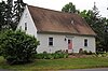 | December 1, 1988 (#88002632) | 161 Damascus Rd. 41°17′07″N 72°46′53″W / 41.285278°N 72.781389°W / 41.285278; -72.781389 (House at 161 Damascus Road) | Branford | Mid-18th-century colonial residence. |
| 87 | House at 29 Flat Rock Road | 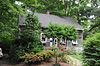 | December 1, 1988 (#88002640) | 29 Flat Rock Rd. 41°17′06″N 72°45′19″W / 41.2851°N 72.7553°W / 41.2851; -72.7553 (House at 29 Flat Rock Road) | Branford | Late 18th century vernacular farmhouse. |
| 88 | Eliphalet Howd House |  | December 1, 1988 (#88002637) | 675 E. Main St. 41°18′10″N 72°45′28″W / 41.302778°N 72.757778°W / 41.302778; -72.757778 (Eliphalet Howd House) | Branford | 18th-century two-story Georgian residence. |
| 89 | Howd-Linsley House |  | December 10, 1986 (#86003382) | 1795 Middletown Ave. 41°24′34″N 72°46′06″W / 41.409444°N 72.768333°W / 41.409444; -72.768333 (Howd-Linsley House) | North Branford | 18th-century saltbox. |
| 90 | John I. Howe House |  | February 6, 1989 (#88003229) | 213 Caroline St. 41°19′24″N 73°05′16″W / 41.323333°N 73.087778°W / 41.323333; -73.087778 (John I. Howe House) | Derby | Home of pin manufacturing pioneer. |
| 91 | Hubbard Park | 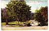 | December 15, 1997 (#97001466) | Roughly bounded by W. Main St., Interstate 691, CT 66, Reservoir Ave., Edgewood Dr., and Berlin and Southington town lines 41°33′45″N 72°50′05″W / 41.5625°N 72.834722°W / 41.5625; -72.834722 (Hubbard Park) | Meriden and, in Hartford County, Berlin and Southington | 1,800 acres (7.3 km2) and home to Castle Craig. |
| 92 | Gen. David Humphreys House | 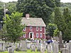 | March 17, 1972 (#72001321) | 37 Elm St. 41°19′52″N 73°04′30″W / 41.331111°N 73.075°W / 41.331111; -73.075 (Gen. David Humphreys House) | Ansonia | Built in the 1690s, this house was the birthplace of the American Revolutionary War Colonel David Humphreys, friend of and aide de camp to General George Washington. |
| 93 | William Hurd House |  | July 29, 1993 (#93000659) | 327 Hulls Hill Rd. 41°27′25″N 73°10′29″W / 41.456944°N 73.174722°W / 41.456944; -73.174722 (William Hurd House) | Southbury | Federal structure built in the late 18th century and enlarged about 1820. |
| 94 | Hurley Road Historic District | 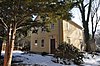 | July 29, 1993 (#93000662) | 6 and 17 Hurley Rd. 41°28′33″N 73°09′31″W / 41.475833°N 73.158611°W / 41.475833; -73.158611 (Hurley Road Historic District) | Southbury | A pair of properties built by cousins in the early 19th-century including Federal and Greek Revival houses and other outbuildings. |
| 95 | Hyland-Wildman House |  | March 26, 1976 (#76001989) | Boston St. 41°16′57″N 72°40′43″W / 41.2825°N 72.678611°W / 41.2825; -72.678611 (Hyland-Wildman House) | Guilford | Saltbox built about 1713 and extensively restored in 1917. |
| 96 | Ives-Baldwin House |  | May 1, 2003 (#03000308) | 474 Baldwin Ave. 41°32′39″N 72°45′42″W / 41.5443°N 72.7616°W / 41.5443; -72.7616 (Ives-Baldwin House) | Meriden | Traditional Georgian farmhouse built about 1798. |
| 97 | Elam Ives House | 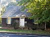 | October 12, 2010 (#10000832) | 95 Ives St. 41°24′13″N 72°53′43″W / 41.403611°N 72.895278°W / 41.403611; -72.895278 (Elam Ives House) | Hamden | Wood-frame structure built in 1790 with a gabled roof, central chimney, and shingled exterior. |
| 98 | Alphonso Johnson House |  | January 17, 1992 (#91001922) | 1 Gilbert Ave. 41°21′26″N 72°56′15″W / 41.357222°N 72.9375°W / 41.357222; -72.9375 (Alphonso Johnson House) | Hamden | Distinctive Greek Revival with Italianate features built in 1859. |
| 99 | Franklin Johnson House |  | November 23, 1998 (#98001420) | 153 S. Main St. 41°27′06″N 72°49′15″W / 41.451667°N 72.820833°W / 41.451667; -72.820833 (Franklin Johnson House) | Wallingford | 1866 Italianate house with stylistically similar multi-seat outhouse. |
| 100 | Theophilus Jones House |  | January 30, 1992 (#91001981) | 40 Jones Rd. 41°26′51″N 72°51′10″W / 41.4475°N 72.852778°W / 41.4475; -72.852778 (Theophilus Jones House) | Wallingford | Built about 1740 and restored in the 1940s by Charles F. Montgomery. |
| 101 | John Kendrick House |  | April 12, 1982 (#82004360) | 119 W. Main St. 41°33′22″N 73°02′36″W / 41.556111°N 73.043333°W / 41.556111; -73.043333 (John Kendrick House) | Waterbury | 1865 brick Italianate house is one of the few remaining residential structures on the Waterbury Green. |
| 102 | Kraus Corset Factory |  | February 12, 1987 (#87000128) | Roosevelt Dr. and 3rd St. 41°19′13″N 73°05′29″W / 41.320278°N 73.091389°W / 41.320278; -73.091389 (Kraus Corset Factory) | Derby | This factory, originally built in 1879, is the only major survivor from Derby's period of corset manufacturing. |
| 103 | Laurel Beach Casino |  | November 1, 2018 (#100003074) | 102 6th Ave. 41°11′04″N 73°05′43″W / 41.1845°N 73.0954°W / 41.1845; -73.0954 (Laurel Beach Casino) | Milford | Colonial Revival from 1929, with a large hall and a bowling alley. Not a casino; used for dances, concerts, and other social gatherings. |
| 104 | Pelatiah Leete House |  | October 1, 1974 (#74002048) | Southwest of Guilford off CT 146 41°15′58″N 72°42′53″W / 41.2661°N 72.7148°W / 41.2661; -72.7148 (Pelatiah Leete House) | Guilford | Built in 1710 with some Greek Revival elements and a saltbox profile. |
| 105 | Isaac C. Lewis Cottage |  | July 25, 1997 (#97000811) | 255 Thimble Islands Rd. 41°15′46″N 72°45′00″W / 41.262778°N 72.75°W / 41.262778; -72.75 (Isaac C. Lewis Cottage) | Branford | Eclectic late-Victorian seaside summer house built in 1882. |
| 106 | Little Pootatuck Brook Archeological Site |  | June 28, 1990 (#90000980) | Address Restricted | Southbury | Believed to be one of the last habitation sites of the Pootatuck tribe. |
| 107 | Madison Green Historic District | 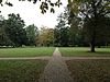 | June 28, 1982 (#82004353) | 446-589 Boston Post Rd. and structures surrounding the green 41°16′41″N 72°36′19″W / 41.278056°N 72.605278°W / 41.278056; -72.605278 (Madison Green Historic District) | Madison | Town green and surrounding structures including the First Congregational Church (1838), Memorial Hall (1896), a community meeting building (c. 1884), Academy Elementary School (1884), and Lee Academy (1821), as well as historic houses, notably the Deacon John Grave House. |
| 108 | Maltby-Stevens Factory Site | 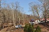 | January 27, 2000 (#99001668) | Address Restricted | North Branford | Remnants of a 19th-century factory that produced an array of products including buttons and dried coconut. |
| 109 | Marion Historic District | 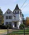 | December 21, 1988 (#88001423) | Along Marion Ave. and Meriden-Waterbury Turnpike 41°33′50″N 72°55′29″W / 41.563889°N 72.924722°W / 41.563889; -72.924722 (Marion Historic District) | Cheshire | Highlights of the district include the Levi B. Frost House, the Barnes-Frost House, the Miles Upson House, and the Lester Beecher House. Extends into Southington; see the Southington list. |
| 110 | Richard Mansfield House |  | March 11, 1971 (#71000906) | 35 Jewett St. 41°20′23″N 73°04′14″W / 41.339722°N 73.070556°W / 41.339722; -73.070556 (Richard Mansfield House) | Ansonia | Saltbox built about 1700. Owned by prominent loyalist Episcopal minister. |
| 111 | Matthews and Willard Factory |  | January 14, 1988 (#87002419) | 16 Cherry Ave. 41°33′24″N 73°02′10″W / 41.556667°N 73.036111°W / 41.556667; -73.036111 (Matthews and Willard Factory) | Waterbury | Brass industry factory complex; now demolished. |
| 112 | Medad Stone Tavern |  | January 30, 2009 (#08001378) | 197 Three Mile Course 41°17′03″N 72°41′46″W / 41.284167°N 72.696111°W / 41.284167; -72.696111 (Medad Stone Tavern) | Guilford | 1803 Federal residence; never actually used as a tavern. |
| 113 | Meeting House Hill Historic District |  | December 14, 1987 (#87002132) | Roughly bounded by Long Hill, Great Hill, and Ledge Hill Rds. 41°22′00″N 72°43′42″W / 41.366667°N 72.728333°W / 41.366667; -72.728333 (Meeting House Hill Historic District) | Guilford | North Guilford Congregational Church, St. John's Episcopal Church, associated buildings and a cemetery. The arrangement reflects a spirit of religious tolerance that allowed churches from two different congregations to heal long-standing divisions. |
| 114 | Meigs-Bishop House | 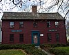 | June 16, 1988 (#88000745) | 45 Wall St. 41°16′52″N 72°35′40″W / 41.281111°N 72.594444°W / 41.281111; -72.594444 (Meigs-Bishop House) | Madison | Saltbox; earliest portion built circa 1690. |
| 115 | Meriden Curtain Fixture Company Factory |  | December 4, 1986 (#86003290) | 122 Charles St. 41°31′52″N 72°47′30″W / 41.531111°N 72.791667°W / 41.531111; -72.791667 (Meriden Curtain Fixture Company Factory) | Meriden | Factory complex buildings, built in 1892, of brick with brownstone foundations and sills. All have a distinctive decorative band of terra cotta tiles below the eaves. |
| 116 | Middlebury Center Historic District |  | May 9, 1985 (#85001019) | Roughly bounded by Library Rd., North and South Sts., and Whittemore Rd. 41°31′35″N 73°07′33″W / 41.526389°N 73.125833°W / 41.526389; -73.125833 (Middlebury Center Historic District) | Middlebury | Civic, religious and residential structures from the 18th to early 20th century. |
| 117 | Milford Point Hotel |  | January 22, 1988 (#87002417) | Milford Point Rd. 41°10′33″N 73°06′07″W / 41.175833°N 73.101944°W / 41.175833; -73.101944 (Milford Point Hotel) | Milford | One of the oldest surviving coastal hotel buildings in the state; now the Connecticut Audubon Society Coastal Center. |
| 118 | Henry F. Miller House | 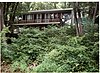 | April 25, 2001 (#01000399) | 30 Derby Ave. 41°18′02″N 72°59′15″W / 41.300556°N 72.9875°W / 41.300556; -72.9875 (Henry F. Miller House) | Orange | International style house from 1949. |
| 119 | Mount Carmel Congregational Church and Parish House |  | December 27, 1991 (#91001847) | 3280 and 3284 Whitney Ave., 195 Sherman Ave. 41°24′50″N 72°54′09″W / 41.413889°N 72.9025°W / 41.413889; -72.9025 (Mount Carmel Congregational Church and Parish House) | Hamden | 1840 Greek Revival church and 1911 Colonial Revival parish house. |
| 120 | Jonathan Murray House | 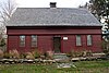 | April 12, 1982 (#82004354) | 76 Scotland Rd. 41°17′11″N 72°34′49″W / 41.286389°N 72.580278°W / 41.286389; -72.580278 (Jonathan Murray House) | Madison | First Period residence built about 1690. |
| 121 | Naugatuck Center Historic District |  | July 30, 1999 (#99000859) | Roughly bounded by Fairview Ave., Hillside Ave., Terrace Ave., Water St., and Pleasant View St. 41°29′29″N 73°03′27″W / 41.491389°N 73.0575°W / 41.491389; -73.0575 (Naugatuck Center Historic District) | Naugatuck | Churches, schools and municipal buildings centered around the town green. Highlights include the Bronson B. Tuttle House and the post office. |
| 122 | Nehemiah Royce House |  | August 24, 1998 (#98000966) | 538 N. Main St. 41°27′59″N 72°48′48″W / 41.466389°N 72.813333°W / 41.466389; -72.813333 (Nehemiah Royce House) | Wallingford | 1672 saltbox house, visited twice by George Washington. |
| 123 | New England Cement Company Kiln and Quarry |  | April 25, 2001 (#00001454) | Address Restricted 41°22′36″N 72°58′40″W / 41.376667°N 72.977778°W / 41.376667; -72.977778 (New England Cement Company Kiln and Quarry) | Woodbridge | Archaeological industrial site. |
| 124 | Norcross Brothers Granite Quarry | 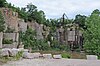 | June 6, 2003 (#03000315) | Quarry Rd. 41°17′01″N 72°44′32″W / 41.283611°N 72.742222°W / 41.283611; -72.742222 (Norcross Brothers Granite Quarry) | Branford | Opened in 1887 and supplied granite for the base of the Statue of Liberty, the Corcoran Gallery of Art, and the Marshall Field and Company Building, among others. |
| 125 | North Branford Center Historic District |  | December 9, 1999 (#99001472) | Roughly along Church and North Sts. 41°19′46″N 72°45′52″W / 41.329444°N 72.764444°W / 41.329444; -72.764444 (North Branford Center Historic District) | North Branford | Includes the town green, Congregational Church, cemetery, and other civic structures, as well as residences dating to the colonial period. |
| 126 | Northford Center Historic District |  | December 31, 2002 (#02001629) | Roughly along Middletown Ave. and parts of Old Post Rd. 41°24′00″N 72°46′59″W / 41.4°N 72.783056°W / 41.4; -72.783056 (Northford Center Historic District) | North Branford | The district includes many fine pre-Civil-War houses (including the Howd-Linsley House), two churches (including the gothic-revival Northford Congregational Church designed by Henry Austin), and a schoolhouse (the Fourth District School). |
| 127 | Norton House | 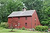 | December 1, 1988 (#88002645) | 200 Pine Orchard Rd. 41°16′16″N 72°46′57″W / 41.2710°N 72.7825°W / 41.2710; -72.7825 (Norton House) | Branford | Circa 1715 saltbox house. |
| 128 | Old West Haven High School |  | October 24, 1985 (#85003368) | 278 Main St. 41°16′23″N 72°56′49″W / 41.2731°N 72.9469°W / 41.2731; -72.9469 (Old West Haven High School) | West Haven | Classical Revival school, converted to residential; also formerly the Giannotti Junior High School. |
| 129 | Orange Center Historic District |  | August 10, 1989 (#89001089) | Roughly Orange Center Rd. from Orange Cemetery to Nan Dr. 41°16′36″N 73°01′40″W / 41.276667°N 73.027778°W / 41.276667; -73.027778 (Orange Center Historic District) | Orange | Includes the federal style 1810 Orange Congregational Church by David Hoadley and the 1878 stick style Academy schoolhouse. |
| 130 | Osbornedale |  | June 13, 1986 (#86001256) | 500 Hawthorne Ave. 41°19′51″N 73°06′27″W / 41.330833°N 73.1075°W / 41.330833; -73.1075 (Osbornedale) | Derby | Historic nineteenth-century farmhouse. |
| 131 | Overlook Historic District |  | June 7, 1988 (#88000662) | Roughly bounded by Hecla St., Farmington and Columbia Boulevard, Cables Ave. and Clowes Terrace, and Lincoln and Fiske Sts. 41°34′13″N 73°02′54″W / 41.570278°N 73.048333°W / 41.570278; -73.048333 (Overlook Historic District) | Waterbury | Includes a fine concentration of residential architecture from the early 20th century, in Colonial Revival, as well as Queen Anne and Craftsman styles. |
| 132 | Palace Theater |  | June 30, 1983 (#83001284) | 86-110 E. Main St. 41°33′19″N 73°02′23″W / 41.555278°N 73.039722°W / 41.555278; -73.039722 (Palace Theater) | Waterbury | Renaissance Revival structure built in 1921 with extensive renovation in 2004. |
| 133 | Hezekiah Palmer House |  | December 1, 1988 (#88002641) | 340-408 Leete's Island Rd. 41°16′30″N 72°45′25″W / 41.275°N 72.756944°W / 41.275; -72.756944 (Hezekiah Palmer House) | Branford | Early 19th century house with transitional Colonial/Greek Revival styling. |
| 134 | Isaac Palmer House | 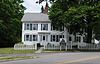 | December 1, 1988 (#88002643) | 736-756 Main St. 41°16′47″N 72°48′57″W / 41.279722°N 72.815833°W / 41.279722; -72.815833 (Isaac Palmer House) | Branford | Circa 1810 Federal residence. |
| 135 | Samuel Parsons House |  | April 12, 1982 (#82004358) | 180 S. Main St. 41°27′04″N 72°49′14″W / 41.451111°N 72.820556°W / 41.451111; -72.820556 (Samuel Parsons House) | Wallingford | Georgian residence built in 1770. |
| 136 | Pine Orchard Union Chapel |  | July 19, 2000 (#00000815) | 25 Chapel Dr. 41°16′00″N 72°46′34″W / 41.2667°N 72.7760°W / 41.2667; -72.7760 (Pine Orchard Union Chapel) | Branford | Queen-Anne seasonal resort chapel from 1897. |
| 137 | Pines Bridge Historic District | 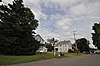 | May 27, 1988 (#88000577) | 3-17 Bishop St., 70-99 Old Broadway, 2-10 Philip Pl., and 9-56 State St. 41°23′15″N 72°52′23″W / 41.3875°N 72.873056°W / 41.3875; -72.873056 (Pines Bridge Historic District) | North Haven | Once a commercial and industrial hub, now mainly residential. Greek Revival, Queen Anne and other Victorian styles predominate. |
| 138 | Pistol Factory Dwelling |  | December 27, 1991 (#91001846) | 1322 Whitney Ave. 41°20′57″N 72°54′51″W / 41.349167°N 72.914167°W / 41.349167; -72.914167 (Pistol Factory Dwelling) | Hamden | Greek Revival worker's boarding house, built by Eli Whitney Jr., son of Eli Whitney, in 1845. |
| 139 | Elisha Pitkin House |  | April 6, 1979 (#79002646) | 173 High Woods Dr. 41°18′56″N 72°42′07″W / 41.315556°N 72.701944°W / 41.315556; -72.701944 (Elisha Pitkin House) | Guilford | The oldest portion dates from 1690. The house was moved from East Hartford in the 1950s. |
| 140 | Plaster House |  | July 29, 1993 (#93000660) | 117 Plaster House Rd. 41°27′00″N 73°10′01″W / 41.45°N 73.166944°W / 41.45; -73.166944 (Plaster House) | Southbury | Mid-18th-century residence built out of rubble stone and covered in stucco. |
| 141 | Col. Asa Platt House | 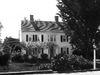 | December 31, 2002 (#02001630) | 2 Tyler City Rd. 41°17′12″N 73°00′41″W / 41.286667°N 73.011389°W / 41.286667; -73.011389 (Col. Asa Platt House) | Orange | Federal-style house from 1810. |
| 142 | Prospect Green Historic District |  | June 16, 2000 (#00000560) | 2, 8, 10, 12, 17, 19, 21, 23, 25, 27, and 30 Center St. 41°30′04″N 72°58′42″W / 41.501111°N 72.978333°W / 41.501111; -72.978333 (Prospect Green Historic District) | Prospect | The town green and surrounding structures including the Tuttle Library (1905), Civil War Monument (1907), Congregational Church (1945), Center School (1867) and Grange (1947). |
| 143 | Quaker Farms Historic District | 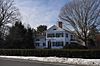 | August 9, 1991 (#91000993) | 467-511 Quaker Farms Rd. 41°25′34″N 73°09′24″W / 41.426111°N 73.156667°W / 41.426111; -73.156667 (Quaker Farms Historic District) | Oxford | Christ Church Episcopal (1814) and 11 houses in Colonial, Federal, Greek Revival, Queen Anne, and Colonial Revival styles. |
| 144 | Red Bridge |  | December 10, 1993 (#93001345) | Near Oregon Rd. over the Quinnipiac River 41°31′20″N 72°50′20″W / 41.522222°N 72.838889°W / 41.522222; -72.838889 (Red Bridge) | Meriden | Lenticular truss. |
| 145 | Nathaniel Richardson House |  | September 19, 1977 (#77001405) | Northeast of Middlebury on Kelly Rd. 41°32′40″N 73°05′37″W / 41.544444°N 73.093611°W / 41.544444; -73.093611 (Nathaniel Richardson House) | Middlebury | Built about 1800, this house is no longer standing. |
| 146 | Rising Sun Tavern |  | August 21, 1979 (#79002638) | Old Tavern Lane 41°22′20″N 72°49′27″W / 41.372222°N 72.824167°W / 41.372222; -72.824167 (Rising Sun Tavern) | North Haven | Well-preserved 18th-century tavern house. |
| 147 | River Park Historic District |  | August 14, 1986 (#86002648) | Roughly bounded by Boston Post Rd., Cherry St. and Amtrak line, and High St. 41°13′38″N 73°03′30″W / 41.227222°N 73.058333°W / 41.227222; -73.058333 (River Park Historic District) | Milford | Centered around a series of parks along the Wepawaug River encompassing the residential and civic heart of the city. Highlights include the Thomas Buckingham House, the town hall (1916) and the Congregational Church (1823). |
| 148 | Riverside Cemetery |  | September 20, 1988 (#88001525) | Riverside St. from Sunnyside to Summit Sts. 41°32′52″N 73°02′57″W / 41.547778°N 73.049167°W / 41.547778; -73.049167 (Riverside Cemetery) | Waterbury | Dedicated in 1853, this cemetery on the bank of the Naugatuck River includes an array of funerary monuments in gothic, neo-classical, and romantic styles. |
| 149 | John Rogers House |  | December 1, 1988 (#88002642) | 690 Leete's Island Rd. 41°16′12″N 72°44′14″W / 41.27°N 72.737222°W / 41.27; -72.737222 (John Rogers House) | Branford | Well-preserved and researched 18th-century New England Colonial house. |
| 150 | Route 146 Historic District | 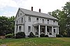 | April 5, 1990 (#90000569) | Route 146 between Flat Rock Rd. and West River bridge 41°16′07″N 72°42′50″W / 41.268611°N 72.713889°W / 41.268611; -72.713889 (Route 146 Historic District) | Branford and Guilford | Rural residential architecture with styles covering from the early 18th to early 20th centuries. Highlights include the John Rogers House and the Pelatiah Leete House. |
| 151 | Russian Village Historic District | 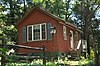 | December 8, 1988 (#88002687) | Roughly Kiev Dr. and Russian Village Rd. between U.S. Route 6 and the Pomperaug River 41°26′56″N 73°15′10″W / 41.448889°N 73.252778°W / 41.448889; -73.252778 (Russian Village Historic District) | Southbury | Summer colony for Russian emigres founded in the 1920s with distinctive Russian touches in the houses and a small chapel. |
| 152 | Sabbathday House | 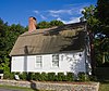 | October 10, 1975 (#75001931) | 19 Union St. 41°17′07″N 72°40′50″W / 41.285278°N 72.680556°W / 41.285278; -72.680556 (Sabbathday House) | Guilford | House built about 1735 for sheltering church-goers between morning and afternoon services. |
| 153 | Salem School | 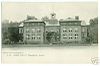 | November 3, 1983 (#83003582) | 124 Meadow St. 41°29′26″N 73°03′27″W / 41.490556°N 73.0575°W / 41.490556; -73.0575 (Salem School) | Naugatuck | Brick Renaissance Revival structure, built in 1893 and designed by McKim, Mead & White. |
| 154 | Sanford Road Historic District | 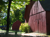 | July 29, 1993 (#93000657) | 480 and 487 Sanford Rd. 41°27′41″N 73°11′05″W / 41.461389°N 73.184722°W / 41.461389; -73.184722 (Sanford Road Historic District) | Southbury | Two farmhouses dating from the late 18th and early 19th centuries, along with associated outbuildings including barns, a chicken coop, a smoke house and a privy. |
| 155 | Sanford-Humphreys House |  | May 11, 1982 (#82004357) | 61-63 West St. 41°23′39″N 73°04′47″W / 41.394167°N 73.079722°W / 41.394167; -73.079722 (Sanford-Humphreys House) | Seymour | The oldest parts of the structure date to the 1790s. Owned first by Samuel Sanford, the area's first doctor, and then by soldier, diplomat, and businessman David Humphreys. |
| 156 | Seymour High School and Annex | 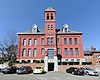 | November 17, 1983 (#83003583) | 100 Bank St. 41°23′51″N 73°04′36″W / 41.3975°N 73.076667°W / 41.3975; -73.076667 (Seymour High School and Annex) | Seymour | Former high school, later an elementary school, now offices including medical offices. |
| 157 | Sheffield Street Bridge |  | April 12, 2001 (#01000353) | Sheffield St. over Hancock Brook 41°35′50″N 73°02′52″W / 41.597222°N 73.047778°W / 41.597222; -73.047778 (Sheffield Street Bridge) | Waterbury | Lenticular pony truss. |
| 158 | Shelley House |  | February 9, 1989 (#89000017) | 248 Boston Post Rd. 41°16′42″N 72°37′45″W / 41.278333°N 72.629167°W / 41.278333; -72.629167 (Shelley House) | Madison | Late 17th-century stone ender enlarged to a saltbox. |
| 159 | Short Beach Historic District | 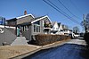 | October 22, 2017 (#100004544) | Roughly bounded by Shore Dr., Beckett & Clarke Aves., Bungalow & Little Bay Lns, Court, Pentecost & Bristol Sts. 41°15′27″N 72°50′56″W / 41.2576°N 72.8488°W / 41.2576; -72.8488 (Short Beach Historic District) | Branford | Shoreline vacation village in Queen Anne, Shingle, and Colonial Revival styles. Stone walls, sea walls and gate posts included as a contributing resource. |
| 160 | Samuel Simpson House |  | June 18, 1986 (#86001334) | 1370 Scard Rd. 41°26′24″N 72°45′29″W / 41.440122°N 72.758116°W / 41.440122; -72.758116 (Samuel Simpson House) | Wallingford | Built in 1838, redesigned about 1867 by Henry Austin and moved from its original location in 1987. |
| 161 | Sleeping Giant Tower | 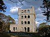 | September 4, 1986 (#86001754) | 200 Mt. Carmel Ave. at Mt. Carmel summit, Sleeping Giant State Park 41°25′50″N 72°53′27″W / 41.430556°N 72.890833°W / 41.430556; -72.890833 (Sleeping Giant Tower) | Hamden | Stone observation tower built in 1936 by the Works Progress Administration. |
| 162 | South Britain Historic District |  | February 12, 1987 (#87000125) | E. Flat Hill, Hawkins, Library, and Middle Rds., and 497-864 S. Britain Rd. 41°28′09″N 73°15′03″W / 41.469167°N 73.250833°W / 41.469167; -73.250833 (South Britain Historic District) | Southbury | Includes houses primarily from the 18th and 19th centuries with Colonial and Greek Revival styles, a Federal church from 1825, and an Italianate town hall from 1873. |
| 163 | Southbury Historic District No. 1 |  | March 11, 1971 (#71000917) | Main St. from Woodbury town line to Old Waterbury Rd. 41°29′42″N 73°12′37″W / 41.495°N 73.210278°W / 41.495; -73.210278 (Southbury Historic District No. 1) | Southbury | Predominantly 18th and 19th century buildings, with few 20th-century intrusions. |
| 164 | Southbury Training School |  | May 1, 1992 (#92000368) | 1484 S. Britain Rd. 41°27′49″N 73°16′23″W / 41.463611°N 73.273056°W / 41.463611; -73.273056 (Southbury Training School) | Southbury | Residential facility built in the 1930s for adults with intellectual disabilities; 125 primarily brick institutional Georgian and Colonial Revival buildings. Extends into Roxbury; see the Litchfield County list. |
| 165 | Southwest District School |  | April 2, 1982 (#82004363) | 155 Nichols Rd. 41°34′49″N 72°59′10″W / 41.580278°N 72.986111°W / 41.580278; -72.986111 (Southwest District School) | Wolcott | Built in the early 1820s from locally quarried granite. |
| 166 | St. Peter's Episcopal Church |  | August 21, 1979 (#79002644) | 61, 71, 81 River St. 41°13′27″N 73°03′27″W / 41.224167°N 73.0575°W / 41.224167; -73.0575 (St. Peter's Episcopal Church) | Milford | Gothic Revival church built from Portland brownstone in 1850–51, along with rectory and parish hall. |
| 167 | Stapleton Building |  | January 14, 1988 (#87002421) | 751 N. Main St. 41°33′49″N 73°01′58″W / 41.563611°N 73.032778°W / 41.563611; -73.032778 (Stapleton Building) | Waterbury | Mixed-use Renaissance Revival building, now demolished. |
| 168 | State Park Supply Yard |  | September 4, 1986 (#86001757) | 51 Mill Rd. 41°16′37″N 72°33′39″W / 41.276944°N 72.560833°W / 41.276944; -72.560833 (State Park Supply Yard) | Madison | Maintenance facility built in 1933-35 by crews of the Civilian Conservation Corps. |
| 169 | Sterling Opera House | 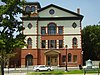 | November 8, 1968 (#68000040) | Northwestern corner of 4th and Elizabeth Sts. 41°19′18″N 73°05′24″W / 41.321667°N 73.090000°W / 41.321667; -73.090000 (Sterling Opera House) | Derby | Amelia Earhart, John L. Sullivan, Harry Houdini, George Burns, Lionel Barrymore, Ethel Barrymore, Red Skelton, and John Philip Sousa appeared on this stage. |
| 170 | Stevenson Dam Hydroelectric Plant | 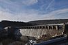 | September 29, 2000 (#00001073) | CT 34 over the Housatonic River 41°23′03″N 73°10′16″W / 41.384167°N 73.171111°W / 41.384167; -73.171111 (Stevenson Dam Hydroelectric Plant) | Oxford | Dam, bridge, and powerhouse built in 1917 on the Housatonic River; extends into Monroe in Fairfield County. |
| 171 | Stick Style House at Stony Creek |  | December 27, 1972 (#72001322) | 32 Prospect Hill 41°15′37″N 72°44′43″W / 41.2604°N 72.7454°W / 41.2604; -72.7454 (Stick Style House at Stony Creek) | Branford | Designed by Henry Austin and built in 1878–80 for William J. Clark, an industrialist, Civil War veteran and state legislator. |
| 172 | Stony Creek-Thimble Islands Historic District | 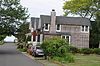 | December 16, 1988 (#88002844) | Roughly Thimble Islands Rd. between Route 146 and Long Island Sound and the Thimble Islands 41°15′33″N 72°45′18″W / 41.259167°N 72.755°W / 41.259167; -72.755 (Stony Creek-Thimble Islands Historic District) | Branford | 19th-century summer resort architecture including Italianate, Greek revival and stick styles (exemplified by the William J. Clark House). |
| 173 | Swain-Harrison House |  | October 10, 1975 (#75001924) | 124 W. Main St. 41°16′41″N 72°49′34″W / 41.278056°N 72.826111°W / 41.278056; -72.826111 (Swain-Harrison House) | Branford | 1724 saltbox house. |
| 174 | Taylor Memorial Library |  | August 21, 1979 (#79002642) | 5 Broad St. 41°13′20″N 73°03′27″W / 41.222222°N 73.0575°W / 41.222222; -73.0575 (Taylor Memorial Library) | Milford | 1894 Richardsonian Romanesque. |
| 175 | Orrin Todd House |  | December 26, 1991 (#91001845) | 3369 Whitney Ave. 41°25′02″N 72°54′11″W / 41.417222°N 72.903056°W / 41.417222; -72.903056 (Orrin Todd House) | Hamden | Federal structure from about 1800; rescued from demolition in 2017. |
| 176 | Tranquility Farm |  | September 23, 1982 (#82004355) | Tranquility Road 41°31′54″N 73°08′16″W / 41.531667°N 73.137778°W / 41.531667; -73.137778 (Tranquility Farm) | Middlebury | Shingle Style main house designed by McKim, Mead & White with landscape design by Warren H. Manning and Charles Eliot. |
| 177 | Bronson B. Tuttle House |  | November 29, 1990 (#90001803) | 380 Church St. 41°29′43″N 73°03′19″W / 41.495278°N 73.055278°W / 41.495278; -73.055278 (Bronson B. Tuttle House) | Naugatuck | Brick Queen Anne mansion from 1879 with projecting gables and porches, a porte-cochère, and a three-story tower. |
| 178 | John Tyler House |  | December 1, 1988 (#88002635) | 242-250 E. Main St. 41°17′29″N 72°47′46″W / 41.291362°N 72.796010°W / 41.291362; -72.796010 (John Tyler House) | Branford | Late First Period residence from 1710. |
| 179 | Solomon Tyler House |  | December 1, 1988 (#88002636) | 260-268 E. Main St. 41°17′31″N 72°47′41″W / 41.291819°N 72.794731°W / 41.291819; -72.794731 (Solomon Tyler House) | Branford | Circa 1770 Georgian. |
| 180 | Union School |  | November 13, 1987 (#87001899) | 174 Center St. 41°16′29″N 72°56′49″W / 41.274722°N 72.946944°W / 41.274722; -72.946944 (Union School) | West Haven | Brick school building from 1890 built in an eclectic Victorian style. |
| 181 | Upper Main Street Historic District |  | December 2, 1982 (#82001004) | 36-100 and 85-117 Main St. 41°20′41″N 73°04′47″W / 41.344722°N 73.079722°W / 41.344722; -73.079722 (Upper Main Street Historic District) | Ansonia | Primarily late-19th century brick commercial buildings including High Victorian Italianate and Neo-Classical Revival styles, anchored by the Ansonia Opera House. |
| 182 | US Post Office-Ansonia Main | 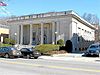 | December 12, 1985 (#85003327) | 237 Main St. 41°20′35″N 73°04′43″W / 41.343056°N 73.078611°W / 41.343056; -73.078611 (US Post Office-Ansonia Main) | Ansonia | Classical Revival with limestone façade from 1914. |
| 183 | US Post Office-Meriden Main |  | January 21, 1986 (#86000129) | 39 N. Colony St. 41°32′41″N 72°48′04″W / 41.544722°N 72.801111°W / 41.544722; -72.801111 (US Post Office-Meriden Main) | Meriden | Former U.S. Post Office, built in 1907 in the Beaux Arts style with fluted Corinthian columns and elaborate cornices. |
| 184 | US Post Office-Milford Main |  | September 25, 1986 (#86002959) | 6 W. River St. 41°13′27″N 73°03′30″W / 41.224167°N 73.058333°W / 41.224167; -73.058333 (US Post Office-Milford Main) | Milford | Red brick Classical Revival, trimmed with limestone, from 1931. |
| 185 | US Post Office-Naugatuck Main | 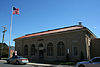 | January 21, 1986 (#86000130) | Church and Cedar Sts. 41°29′32″N 73°03′23″W / 41.492222°N 73.056389°W / 41.492222; -73.056389 (US Post Office-Naugatuck Main) | Naugatuck | Buff-colored brick building with ivory terra cotta ornament, marble accents, decorative brick panels and a hipped red clay tile roof. |
| 186 | Wallingford Center Historic District |  | December 2, 1993 (#93001242) | Roughly Main St. from Ward St. to Church St. 41°27′11″N 72°49′14″W / 41.453056°N 72.820556°W / 41.453056; -72.820556 (Wallingford Center Historic District) | Wallingford | Residential, civic, commercial, and institutional structures primarily from the 18th and 19th-century including colonial, Greek Revival, Italianate, and Queen Anne architecture. The Samuel Parsons House is within the district. |
| 187 | Wallingford Railroad Station |  | November 19, 1993 (#93001245) | 51 Quinnipiac St. (37 Hall Ave.) 41°27′24″N 72°49′32″W / 41.456667°N 72.825556°W / 41.456667; -72.825556 (Wallingford Railroad Station) | Wallingford | Former station building in Second Empire style from 1871 with distinctive Mansard roof and decorative brackets. |
| 188 | Ward-Heitman House | 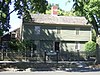 | January 8, 2003 (#02001691) | 277 Elm St. 41°16′34″N 72°57′08″W / 41.276111°N 72.952222°W / 41.276111; -72.952222 (Ward-Heitman House) | West Haven | Oldest house in West Haven; now a museum. |
| 189 | Washington Avenue Bridge |  | April 12, 2001 (#01000354) | Washington Ave. over the Mad River 41°32′38″N 73°02′18″W / 41.543889°N 73.038333°W / 41.543889; -73.038333 (Washington Avenue Bridge) | Waterbury | Lenticular pony truss. |
| 190 | Washington Bridge |  | September 29, 2004 (#04001093) | U.S. Route 1 at the Housatonic River 41°12′01″N 73°06′39″W / 41.200278°N 73.110833°W / 41.200278; -73.110833 (Washington Bridge) | Milford | Open-spandrel concrete arch bascule bridge; extends into Stratford in Fairfield County. |
| 191 | Waterbury Brass Mill |  | September 5, 1975 (#75001943) | Idlewood Ave. in Hamilton Park 41°32′26″N 73°01′04″W / 41.540556°N 73.017778°W / 41.540556; -73.017778 (Waterbury Brass Mill) | Waterbury | Site of a large brass mill; now athletic fields. |
| 192 | Waterbury Clock Company |  | November 30, 1982 (#82001005) | N. Elm and Cherry Sts. and Cherry Ave. 41°33′30″N 73°02′06″W / 41.558333°N 73.035°W / 41.558333; -73.035 (Waterbury Clock Company) | Waterbury | Factory complex home, from 1873-1944, to the forerunner of Timex. |
| 193 | Waterbury Municipal Center Complex |  | October 10, 1978 (#78002882) | 195, 235, and 236 Grand St. and 7, 35, and 43 Field St. 41°33′13″N 73°02′36″W / 41.5536°N 73.0433°W / 41.5536; -73.0433 (Waterbury Municipal Center Complex) | Waterbury | Cass Gilbert-designed complex from 1910s meant to create one unified complex of city government, corporate headquarters and charitable office in accord with City Beautiful movement principles. |
| 194 | Waterbury Union Station | 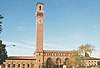 | March 8, 1978 (#78002881) | 389 Meadow St. 41°33′18″N 73°02′51″W / 41.555°N 73.0475°W / 41.555; -73.0475 (Waterbury Union Station) | Waterbury | 1908 station meant to be grand entrance to city being rebuilt after fire; clock tower has become symbol of the city. |
| 195 | Webster School |  | June 14, 1982 (#82004365) | Easton Ave. at Aetna St. 41°34′00″N 73°01′53″W / 41.5667°N 73.0314°W / 41.5667; -73.0314 (Webster School) | Waterbury | Neo-Classical former elementary school built in 1898 from red brick with limestone details and a projecting wooden cornice. |
| 196 | West Haven Green Historic District | 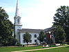 | August 11, 2000 (#00000832) | Roughly along Main St., Campbell St., Church St., and Savin St. 41°16′15″N 72°57′01″W / 41.2708°N 72.9503°W / 41.2708; -72.9503 (West Haven Green Historic District) | West Haven | Historic town green dominated by Congregational Church (1859); surrounding structures include Queen Anne and Italianate styles. |
| 197 | West Haven VA Hospital Historic District | Upload image | May 26, 2022 (#100007728) | 950 Campbell Ave. 41°17′06″N 72°57′29″W / 41.2849°N 72.9581°W / 41.2849; -72.9581 (West Haven VA Hospital Historic District) | West Haven | |
| 198 | Adin Wheeler House and Theodore F. Wheeler Wheelwright Shop |  | July 29, 1993 (#93000661) | 125 Quaker Farms Rd. 41°27′37″N 73°09′49″W / 41.4603°N 73.1636°W / 41.4603; -73.1636 (Adin Wheeler House and Theodore F. Wheeler Wheelwright Shop) | Southbury | Fine late 18th-century Georgian colonial and remarkably complete late 19th-century workshop. |
| 199 | Wheeler-Beecher House |  | July 15, 1977 (#77001400) | 562 Amity Rd. 41°25′42″N 72°59′44″W / 41.4283°N 72.9956°W / 41.4283; -72.9956 (Wheeler-Beecher House) | Bethany | Federal period house designed by David Hoadley. |
| 200 | Henry Whitfield House | 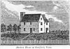 | September 25, 1997 (#72001327) | 248 Old Whitfield St. 41°16′40″N 72°40′31″W / 41.2778°N 72.6753°W / 41.2778; -72.6753 (Henry Whitfield House) | Guilford | The oldest house in Connecticut, built in 1639. |
| 201 | Eli Whitney Gun Factory |  | August 13, 1974 (#74002049) | 915-940 Whitney Ave. 41°20′09″N 72°54′38″W / 41.3357°N 72.9106°W / 41.3357; -72.9106 (Eli Whitney Gun Factory) | Hamden | Pioneering factory of the American Industrial Revolution, using water-powered machinery and standardized, interchangeable parts; now a museum. |
| 202 | Whitneyville Congregational Church |  | July 28, 1995 (#95000906) | 1247-1253 Whitney Ave. 41°20′48″N 72°54′47″W / 41.3467°N 72.9131°W / 41.3467; -72.9131 (Whitneyville Congregational Church) | Hamden | Greek Revival from 1834. |
| 203 | Wilby High School | 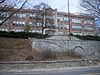 | June 14, 1982 (#82004366) | 260 Grove St. 41°33′36″N 73°02′45″W / 41.56°N 73.0458°W / 41.56; -73.0458 (Wilby High School) | Waterbury | Tudor revival from 1920; it served as a school until 1978. |
| 204 | Wolcott Green Historic District | 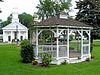 | March 31, 2000 (#00000297) | Roughly bounding Wolcott Green 41°36′05″N 72°58′33″W / 41.6014°N 72.9758°W / 41.6014; -72.9758 (Wolcott Green Historic District) | Wolcott | Triangular town green and surrounding buildings including the Greek Revival Congregational Church, town hall, and a number of 18th- and 19th-century houses. |
| 205 | Harcourt Wood Memorial Library | 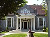 | January 4, 1982 (#82004348) | 313 Elizabeth St. 41°19′36″N 73°05′20″W / 41.3267°N 73.0889°W / 41.3267; -73.0889 (Harcourt Wood Memorial Library) | Derby | Colonial Revival building from 1902, funded by Derby's streetcar railway owner. |
| 206 | Woodbridge Green Historic District | 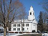 | April 18, 2003 (#03000233) | 3, 4, 7, 11 Meetinghouse Ln. and 4 and 10 Newton Rd. 41°21′14″N 73°00′46″W / 41.3539°N 73.0128°W / 41.3539; -73.0128 (Woodbridge Green Historic District) | Woodbridge | Colonial and Classical Revival architecture in the town's historic center. |
| 207 | Wooster Sawmill and Gristmill Site |  | August 17, 2001 (#01000879) | Park Road at Little River[9] 41°24′35″N 73°05′54″W / 41.4097°N 73.0983°W / 41.4097; -73.0983 (Wooster Sawmill and Gristmill Site) | Oxford | The water-powered mill complex at this site operated for over 200 years. |
See also
Wikimedia Commons has media related to National Register of Historic Places in New Haven County, Connecticut.
- List of National Historic Landmarks in Connecticut
- National Register of Historic Places listings in Connecticut
References
- ^ The latitude and longitude information provided in this table was derived originally from the National Register Information System, which has been found to be fairly accurate for about 99% of listings. Some locations in this table may have been corrected to current GPS standards.
- ^ National Park Service, United States Department of the Interior, "National Register of Historic Places: Weekly List Actions", retrieved September 5, 2024.
- ^ Numbers represent an alphabetical ordering by significant words. Various colorings, defined here, differentiate National Historic Landmarks and historic districts from other NRHP buildings, structures, sites or objects.
- ^ "National Register Information System". National Register of Historic Places. National Park Service. March 13, 2009.
- ^ The eight-digit number below each date is the number assigned to each location in the National Register Information System database, which can be viewed by clicking the number.
- ^ "Historic Properties Commission Minutes, January 2009" (PDF). Town of Wallingford. Retrieved 2017-01-18.
- ^ Janice L. Elliott; Marian Staye (March 10, 1988). "National Register of Historic Places Inventory-Nomination: Edgerton". National Park Service. and Accompanying 17 photos from 1988, and 2 of mansion in 1960 and 1964 (captions on page 10 of text document)
- ^ "Madison Historic Sites". Madison Historical Society. Archived from the original on 2015-03-20. Retrieved 2014-11-21.
- ^ "Park Road Mill Operated for Centuries". Patch.com. Retrieved 2021-04-06.
- v
- t
- e
- Fairfield
- Hartford
- Litchfield
- Middlesex
- New Haven
- New London
- Tolland
- Windham


