Topli Vrh, Črnomelj
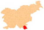
Place in White Carniola, Slovenia
45°34′27.46″N 15°6′31.75″E / 45.5742944°N 15.1088194°E / 45.5742944; 15.1088194 Slovenia
 (2002)
Topli Vrh (pronounced [ˈtɔːpli ˈʋəɾx]; also Topli Vrh nad Bistrico,[2] German: Warmberg[3][4]) is a remote abandoned settlement in the Municipality of Črnomelj in the White Carniola area of southeastern Slovenia. The area is part of the traditional region of Lower Carniola and is now included in the Southeast Slovenia Statistical Region.[5] Its territory is now part of the village of Rožič Vrh.
History
Topli Vrh was a Gottschee German village. In 1770 it had 11 houses, but in 1931 only six. It was burned by Italian troops during the Rog Offensive in the summer of 1942 and was not rebuilt. The Loka pri Črmošnjice hunting club built a hunting lodge at the site in 1960.[2]
References
- ^ Statistical Office of the Republic of Slovenia
- ^ a b Savnik, Roman (1971). Krajevni leksikon Slovenije, vol. 2. Ljubljana: Državna založba Slovenije. p. 61.
- ^ Leksikon občin kraljestev in dežel zastopanih v državnem zboru, vol. 6: Kranjsko. 1906. Vienna: C. Kr. Dvorna in Državna Tiskarna, p. 38.
- ^ Ferenc, Mitja. 2007. Nekdanji nemški jezikovni otok na kočevskem. Kočevje: Pokrajinski muzej, p. 4.
- ^ Črnomelj municipal site
External links
- Topli Vrh on Geopedia
- Pre–World War II list of oeconyms and family names in Topli Vrh
- v
- t
- e
Administrative seat: Črnomelj
- Črnomelj Castle
- Črnomelj Mithraeum
- Lahinja Regional Park
- Stonič Castle
- St. Peter's Parish Church
 | This article about the Municipality of Črnomelj in Slovenia is a stub. You can help Wikipedia by expanding it. |
- v
- t
- e


