Vranoviči
Place in White Carniola, Slovenia
45°36′7.98″N 15°14′4.92″E / 45.6022167°N 15.2347000°E / 45.6022167; 15.2347000 Slovenia
 (2020)
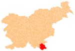
Vranoviči (pronounced [ˈwɾaːnɔʋitʃi]; German: Uranowitsch[2]) is a settlement on the left bank of the Lahinja River in the Municipality of Črnomelj in the White Carniola area of southeastern Slovenia. The railway line from Črnomelj to Metlika runs alongside the main road through the settlement. The area is part of the traditional region of Lower Carniola and is now included in the Southeast Slovenia Statistical Region.[3]
References
External links
- Vranoviči on Geopedia
- v
- t
- e
Administrative seat: Črnomelj
- Črnomelj Castle
- Črnomelj Mithraeum
- Lahinja Regional Park
- Stonič Castle
- St. Peter's Parish Church
 | This article about the Municipality of Črnomelj in Slovenia is a stub. You can help Wikipedia by expanding it. |
- v
- t
- e


